

Badger-Two Medicine
Photos and Story by Tara Kramer
We followed grizzly tracks along the old road bed for the entire first day. Over a pass, along the ridge, down into the thin waters of the South Fork of the Badger. We’d loose the tracks then watch them reappear on hardened mud, just before a turn in the trail or a blind hilltop. The tracks ran both directions, heading back towards where we started from, heading off to where we were going.
We’d parked at a forest service gate, smashed open by a truck or tractor or something large with an engine. The washed out two-track continued from there, and we went on foot. We’d turned from the cutoff road, driven miles across the reservation through rolling hills of wildflowers, stopped to open a handful of cattle fences. I’d pull tension on the barbed wire loop that held the fences together, straining in the full sun in flip flops. Sometimes Nick got out to help, then we’d drive on.
For years we’d looked to this bit of land known as the Badger-Two Medicine. An undesignated area tucked between the Bob Marshall Wilderness (the Bob) and Glacier National Park, rolling out into the Blackfeet Reservation. Two summers ago we traversed the Bob on foot and in packrafts. Just days before this trip we’d bikerafted the western edge of Glacier. If backcountry camping were permitted on the reservation, we’d have chosen to paddle the most remote stretch of the Two Medicine River.
But that day, we walked to find the headwaters of Badger Creek. We didn’t know the flows, whether it had been paddled, where to begin, the rapids or mileage of the water. We studied topos and went to see what we pieced together from the map and websites and blogs. An unprotected piece of one of the largest intact ecosystems in the lower 48. A critical migratory pathway for grizzlies, wolverines, and elk. A sacred area used by the Blackfeet for over 10,000 years, and a place threatened by oil and gas leases since the ‘80s. We went into a quiet piece of land, a hidden triangle of wildness.
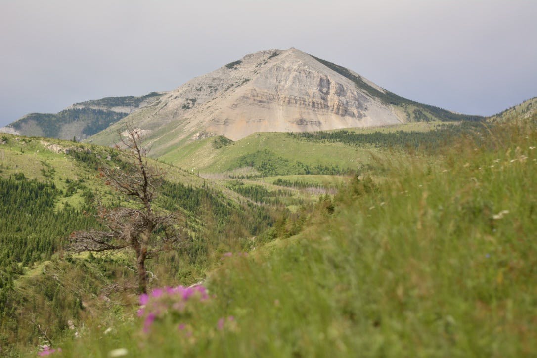
It was midsummer and hot. Within those first few miles we came upon the burn. We had hoped, at first, that the forest of firs we started through would return. But looking from the ridgeline up valley to the South Fork, then down valley to its confluence with the North Fork, all was clear. Burn, far and vast and fully exposed. The grizzly tracks were joined by heavy mosquitoes. I distracted myself with glacier lilies and new shades of paintbrush and all the other flowers I didn’t know. Look at that one, I’d yell out. Nick was silent. He has an unwavering awareness for bears. Me, flowers.
We came upon the mainstem of the Badger in early evening as it tumbled out of a steep gorge. The water spread with the valley, running thin and fast, cold and clear through the burnt forest. Looking for a place to cross, I called to Nick to stop. A fat black bear meandered through bramble, a few hundred feet away on the hillside. We stopped to admire its slowness, its normalcy, the way we didn’t startle it as it had startled us. We made our way through the shallows, considered if we’d be able paddle, then found an old camp, a fire ring, a tipi frame of entwined lodgepole. A large clearing beneath the only stand of live pines.
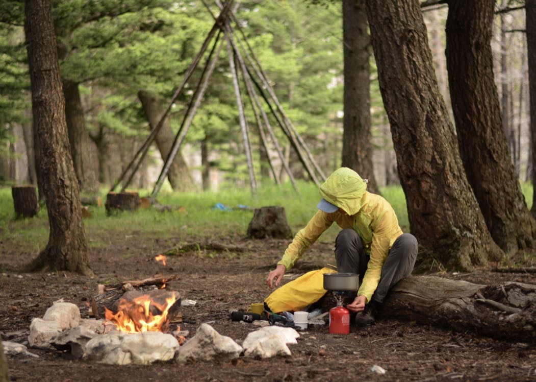
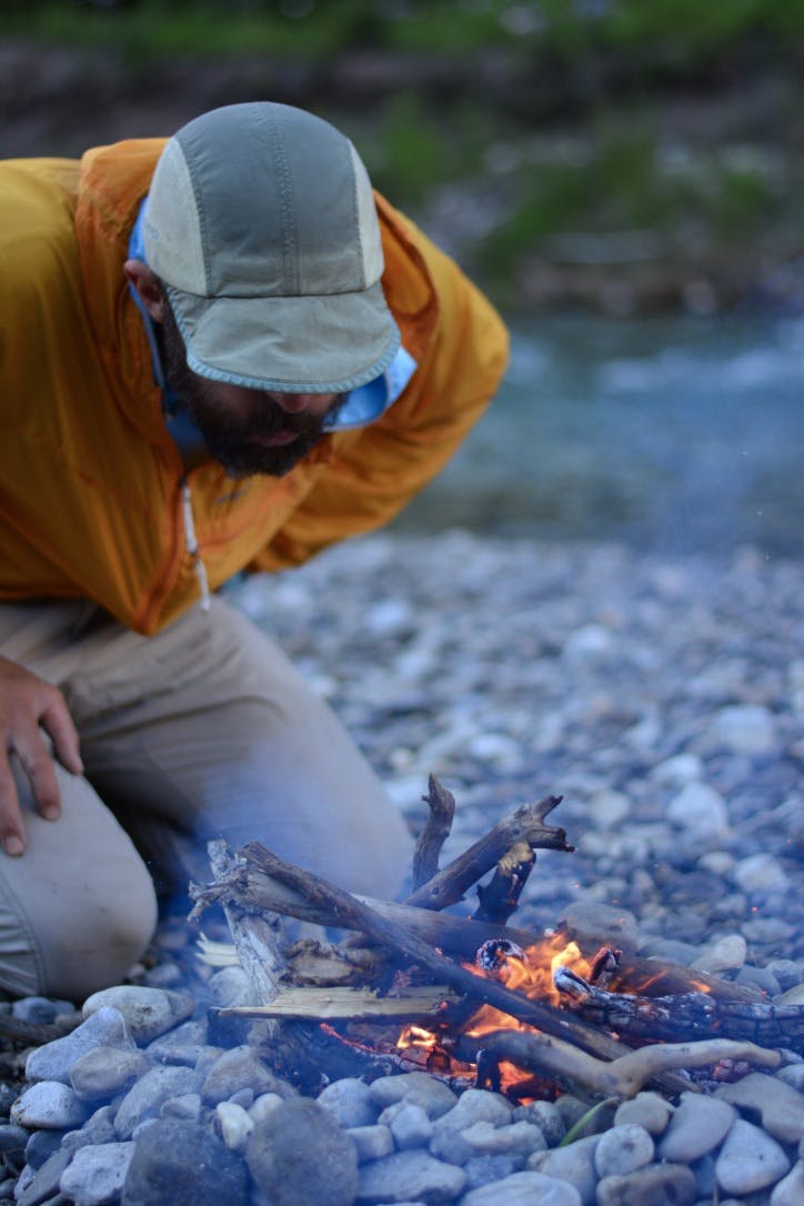
In the low light we made a small fire, instant potatoes, and salmon that comes in small foil packets. We sat around the warmth and watched the Badger. Low and quiet and alone, all but from us and the bears and the immense wildness.
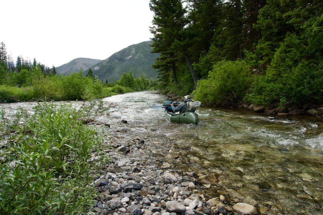
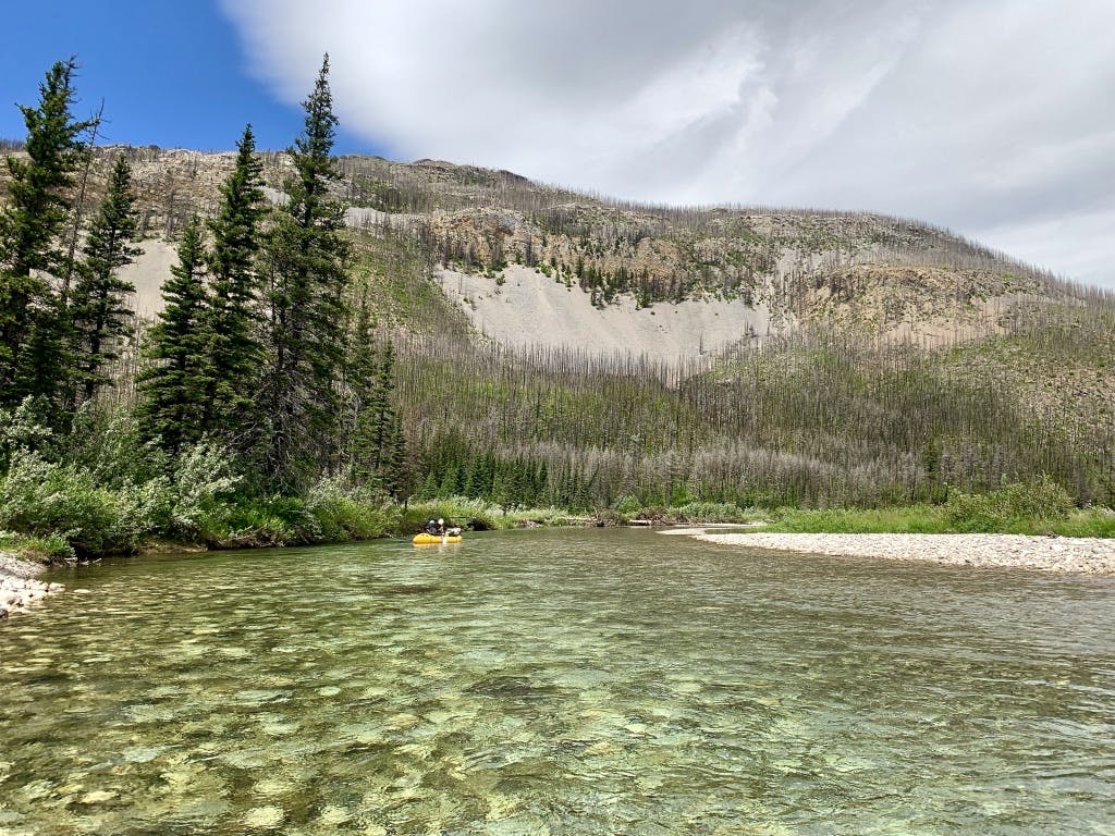
After breakfast of oats and a few bars, we waded into the water and again measured the flow against our knees. We looked downstream, imagined the blind twists, the shallow rock bars, the green pools beneath the cliff bands and willows. The little creek ran low, but we thought we would scrape through, as far as summer water would allow.
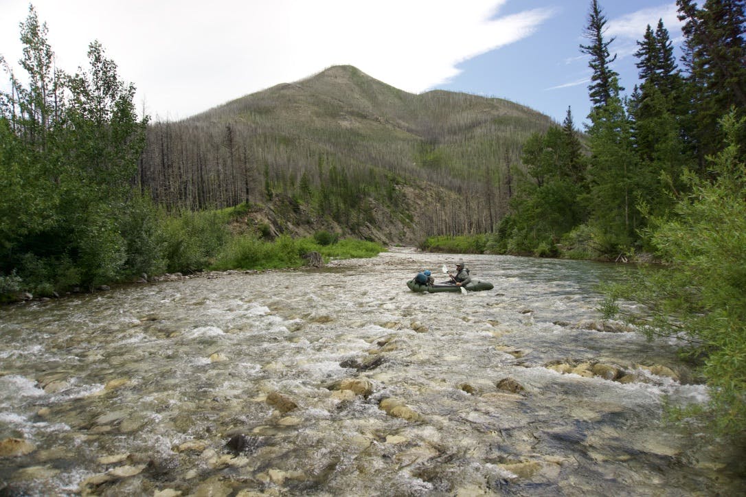
We paddled and scratched through the thinness. We ducked through turns, picked up water from tiny creeks, scraped and weaved and then sat on our PFDs on a gravel bar with moose prints in the sun. We were heading downriver, in our boats. Through charred forest and fishless waters and the expanse of gray-gold scree.
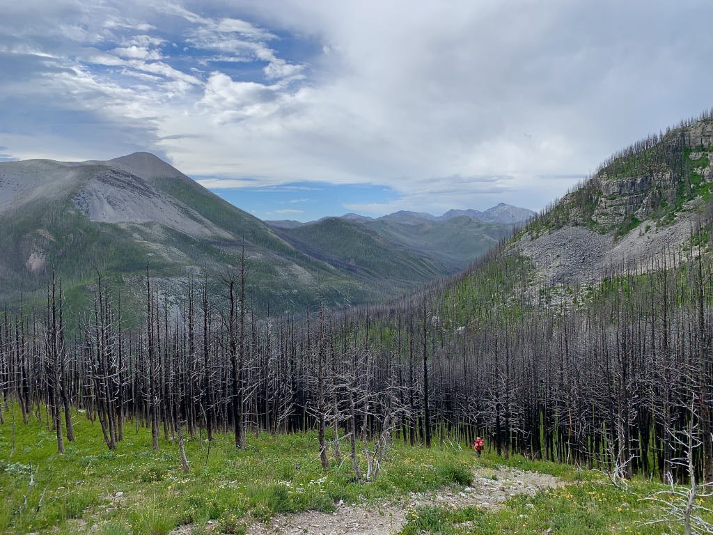
The ranger we’d seen the day before, with his mules and chainsaw slung on their packs and soot covering his face, told us the valley burned in 2007, 2015, and 2017. There had been little reprieve, and the memory of fire spread everywhere along the creek and up the mountains. No trees, no shade, no snow. Here, we’d found the Badger.
Mid-afternoon we heard the rumble of the gorge. The valley steepened to a canyon, and the pools grew deeper and darker and fast. The trail, we knew, crossed back to the creek, and when we found it, we pulled our boats into the forest and walked to see the roar. A thunderous echo between twin headwalls, the Badger exited its pocket of land and poured from the mountains into the grasslands.
We made camp there on the faint trail, where we knew we shouldn’t. We hesitated at the end of the paddling and transitioned from water to foot, spreading out rain pants, camp pads, PFD’s, wet straps, and cold socks. At sunset we fished the barren water, ate grits, swatted mosquitoes, and admired the exposed peaks beyond the scorched pines.
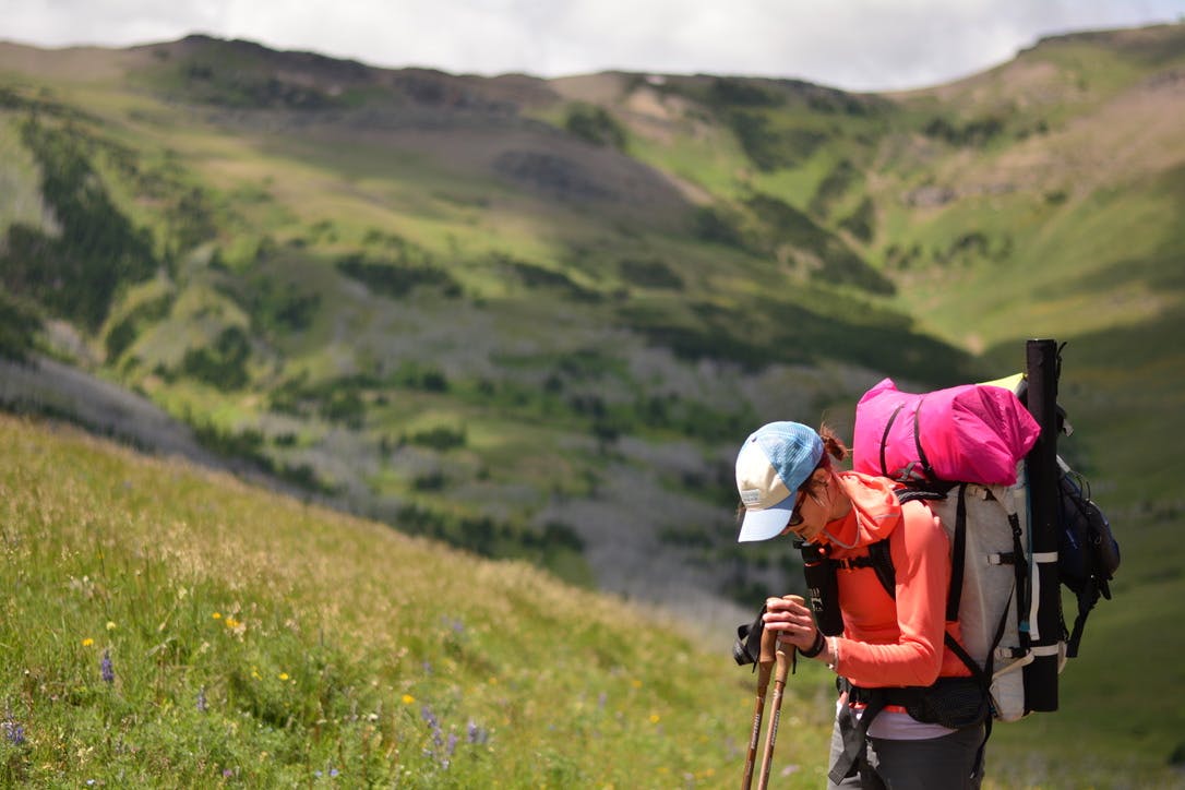
We slept in the overgrown clearing, and in the morning, rolled up our boats and ascended out of the canyon on loose talus, along a ridge and into the foothills. We considered descending a ravine, circled it instead, then looked back to see a grizzly high in the steepness, watching us watching it. We sat on our packs and stared. We ate figs and wished we had binoculars. The bear walked slow into the thickness, disappeared, and became again the caution we carried into the hills.
We continued to an intersection of two trails. On the map, one crossed a pass, and the other led through lowlands, from forest service to reservation and back again. The prairie opened below, mottled with potholes and green meadows and easy hills leading into the plains. We stood at the intersection and chose low. A faint path into the morning. We expected an easy hike.
But that afternoon we crashed through thickets of willows, hillsides of young aspens, forests of deadfall laying like matchsticks. The mosquitoes swarmed our ears and bled through my sleeves. I carried parts of my paddle that branches had pulled from my pack. We crawled through the openings in the brush, I punctured my water bladder throwing my pack onto a pile of rocks, and we banged, and screamed, and yelled to all the bears whose fresh droppings we walked with along the way. For hours, with no trail.
Our GPS told us that we were on the trail. Just a few meters up the hill, circling through firs below us, straight into the willow bog. In a last meadow after the last long thicket, we saw one more bear. A brown bear, or a black bear? Too far to say. We finished the bag of jerky and watched the little spot move across the field, down into the grasslands.
We thrashed the last couple of hours, crawled over fences, saw the road we’d driven in on, dropped closer, and closer, and closer. We came to an overgrown clearing, or maybe it was a turnaround, that was almost to a place we knew. We looked back to see a brown forest service sign and its vertical trail number marking the trail, that we never found.
The thickness, the scarcity, the exposure of land without designations or welcome signs or parking lots. A triangle on the map held in history, handed over to government, gas, and now fire. The public is on track to forget the wide scree fields, the trickles exiting long valleys, the bears, the people that have known this place. And now, I was walking out.
From the clearing we took the road. 20 minutes back to the truck, following dried grizzly tracks as far as we went.
Interested in learning more? Visit glaciertwomedicine.org to learn more about efforts to protect the Badger-Two Medicine Area.
Be responsible. If you are thinking about taking a trip to this area (or any area), please make sure to check with the Forest Service and Blackfeet Nation Fish and Wildlife page to ensure you have the proper permits necessary for entering these areas. Know the rules and regulations before you go!